Page 1 of 1
How is your winter?
Posted: Wed Dec 14, 2011 4:56 pm
by Olli
Up here where I live it should be -10 to -15 celsius and at least 20 cm of snow.
What we have though, is +2 and what little snow we had is now melting. It's like spring, but not.
So I was wondering what kind of winter others were having. Is it normal or as funky as ours?
Re: How is your winter?
Posted: Wed Dec 14, 2011 6:44 pm
by Weresmilodon
Sound just like what i have. At least it stopped raining...
Damn it, i miss last years winter.
Re: How is your winter?
Posted: Wed Dec 14, 2011 7:42 pm
by boballab
Actually what you are experiencing is not that funky, it is just what happens when the Arctic Oscillation (AO) goes positive. Last year at this time the AO was negative which allowed very cold arctic air to drop much further south.
The Arctic Oscillation
The Arctic Oscillation refers to opposing atmospheric pressure patterns in northern middle and high latitudes.
The oscillation exhibits a "negative phase" with relatively high pressure over the polar region and low pressure at midlatitudes (about 45 degrees North), and a "positive phase" in which the pattern is reversed. In the positive phase, higher pressure at midlatitudes drives ocean storms farther north, and changes in the circulation pattern bring wetter weather to Alaska, Scotland and Scandinavia, as well as drier conditions to the western United States and the Mediterranean. In the positive phase, frigid winter air does not extend as far into the middle of North America as it would during the negative phase of the oscillation. This keeps much of the United States east of the Rocky Mountains warmer than normal, but leaves Greenland and Newfoundland colder than usual. Weather patterns in the negative phase are in general "opposite" to those of the positive phase, as illustrated below.
Over most of the past century, the Arctic Oscillation alternated between its positive and negative phases. Starting in the 1970s, however, the oscillation has tended to stay in the positive phase, causing lower than normal arctic air pressure and higher than normal temperatures in much of the United States and northern Eurasia.
http://nsidc.org/arcticmet/patterns/arc ... ation.html
Right now the AO is strongly positive and has been since late November which can be see here:
http://www.cpc.ncep.noaa.gov/products/p ... index.html
Also the AO is forcasted to stay positive through the next two weeks:
http://www.cpc.ncep.noaa.gov/products/p ... ensm.shtml
Re: How is your winter?
Posted: Thu Dec 15, 2011 4:28 am
by dellstart
wel lin the Big Apple ,it has so far been a bit of a mixed bag. mostly nice with a few cold ones mixed in.Though nights are indeed getting colder
Re: How is your winter?
Posted: Thu Dec 15, 2011 9:41 am
by Spec8472
If this year is like last year, it'll be a very cool Christmas - probably 25C or so.
Which is very odd, because it's normally up around the 35C mark.
Winter? No, it's Summer for half the planet, thanks.
Re: How is your winter?
Posted: Thu Dec 15, 2011 10:56 am
by Cougar2k2
So far winter has been extremely crazy here in Ohio. Mainly rain most days it seems with only 2 light flurries thus far. Oh and just 3 days ago the temperature was hovering around 25F to 30F and now its raining again and mid 50'sF. *shakes fist at the sky* Damn you global warming or maybe since the world is ending next year (no I don't actually think it will) the planet it just messing with our heads...
Re: How is your winter?
Posted: Thu Dec 15, 2011 12:03 pm
by Lochar
Spec8472 wrote:If this year is like last year, it'll be a very cool Christmas - probably 25C or so.
Which is very odd, because it's normally up around the 35C mark.
Winter? No, it's Summer for half the planet, thanks.
We can't help that you upside down people are all inside out.
Re: How is your winter?
Posted: Thu Dec 15, 2011 1:06 pm
by Greymist
It has been very mild in London so far, very dry, and above freezing. I'm just hoping it stays dry, as I don't enjoy getting soaked on my 14.5km/9mile cycle to/from work.
Re: How is your winter?
Posted: Thu Dec 15, 2011 3:41 pm
by Rambulator
Very wet and cold here in OK, I guess it is trying to make up for the very dry summer. Ticks me off because I can't get out and work around the place much.
Re: How is your winter?
Posted: Thu Dec 15, 2011 10:25 pm
by kal
Spec8472 wrote:If this year is like last year, it'll be a very cool Christmas - probably 25C or so.
Which is very odd, because it's normally up around the 35C mark.
Winter? No, it's Summer for half the planet, thanks.
that makes me want to fly south for the winter

Re: How is your winter?
Posted: Thu Dec 15, 2011 11:23 pm
by expedient
kal wrote:that makes me want to fly south for the winter
I'm driving north (in the northern hemisphere) tomorrow.

Re: How is your winter?
Posted: Fri Dec 16, 2011 12:22 am
by GBLW
boballab wrote:Actually what you are experiencing is not that funky, it is just what happens when the Arctic Oscillation (AO) goes positive. Last year at this time the AO was negative which allowed very cold arctic air to drop much further south.
I'd say it's a bit more than AO - since it appears that Canada's arctic sea ice is the least on record for MANY years -
http://www.cbc.ca/news/technology/story ... -loss.html
and recently -
http://www.cbc.ca/news/interactives/map ... e-regions/
As for the weather locally, it's a bit warmer than normal and we're not having quite as much rain as we usually do. Of course last year at this time we were starting to worry about not having any snow at all for the winter oh-limp-ix.
The whole problem is we base our expectations on climate - only what we have to live with is weather.
kp
Re: How is your winter?
Posted: Sun Dec 18, 2011 7:33 am
by boballab
GBLW wrote:boballab wrote:Actually what you are experiencing is not that funky, it is just what happens when the Arctic Oscillation (AO) goes positive. Last year at this time the AO was negative which allowed very cold arctic air to drop much further south.
I'd say it's a bit more than AO - since it appears that Canada's arctic sea ice is the least on record for MANY years -
http://www.cbc.ca/news/technology/story ... -loss.html
and recently -
http://www.cbc.ca/news/interactives/map ... e-regions/
As for the weather locally, it's a bit warmer than normal and we're not having quite as much rain as we usually do. Of course last year at this time we were starting to worry about not having any snow at all for the winter oh-limp-ix.
The whole problem is we base our expectations on climate - only what we have to live with is weather.
kp
What you linked to was a comparison of what it is now to over 1400 years ago and what summer sea ice was compared to 1968, so it's not that great of a comparison for how is the weather up there for this time of year. Besides you get different answers depending how far back you look, as an example at one time crocodiles lived almost all the way to what is now the arctic circle (about 125,000 years ago). A better place to look to compare is from these links:
http://arctic-roos.org/observations/sat ... ce_ext.png (From Norway)
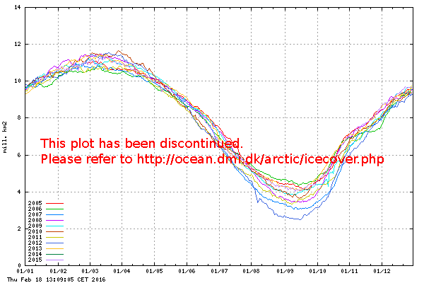
http://ocean.dmi.dk/arctic/plots/icecov ... urrent.png (From Denmark)
http://nsidc.org/data/seaice_index/imag ... series.png (US National Snow and Ice Data Center)
http://arctic.atmos.uiuc.edu/cryosphere ... arctic.png (University of Illinois)
These are all graphs that compare Arctic Sea Ice for the last couple of years. What you find from all of them is that Arctic Sea Ice right now is well above where it was in 2010. The reason for that is the AO. The AO in turn effects where the Polar Jet stream runs, negative AO the Jet Stream moves south and in turn steers storms into Spain and the med, positive the Jet stream stays further north and the storms follow it. That was the reason Scotland had that big storm a week or two back.
Matter of fact here is a Press Release from the NSIDC:
November 2, 2011
A rapid freeze-up
Arctic sea ice extent increased rapidly through October, as is typical this time of year. Large areas of open water were still present in the Beaufort and Chukchi seas at the end of the month. The open water contributed to unusually warm conditions along the coast of Siberia and in the Beaufort and Chukchi seas.
When you get further down into it you find this:
Atmospheric conditions
In recent years, low sea ice extent in the summer has been linked to unusually warm temperatures at the surface of the Arctic Ocean in the fall. This pattern appeared yet again this fall.
Air temperatures over most of the Arctic Ocean for October 2011 ranged from 1 to 4 degrees Celsius (1.8 to 7.2 degrees Fahrenheit) above average, measured at the 925 millibar level, about 1,000 meters or 3,000 feet above the surface. However, over the eastern Canadian Arctic and Greenland, temperatures were as much as 3 degrees Celsius (5.4 degrees Fahrenheit) below average.
These temperature anomalies in part reflect a pattern of above-average sea level pressure centered over the northern Beaufort Sea, and lower than average sea level pressure extending across northern Eurasia. This pattern is linked to persistence of the positive phase of the Arctic Oscillation through most of the month. These pressure and temperature anomalies tend to bring in heat from the south, warming the Eurasian coast, but they also lead to cold northerly winds over the eastern Canadian Arctic Archipelago. However, along the Siberian coast and in the Beaufort and Chukchi seas, warmer temperatures came primarily from the remaining areas of open water in the region, as heat escaped from the water. These effects are more strongly apparent in the surface air temperatures: average October temperatures in the region were 5 to 8 degrees Celsius (9.0 to 14.4 degrees Fahrenheit) above average.
http://nsidc.org/arcticseaicenews/2011/110211.html
Then from December:
December 5, 2011
Winter in the Arctic: Ice and storms
Northern Hemisphere snow cover
The positive phase of the Arctic Oscillation also tends to be associated with unusually warm conditions over Scandinavia. According to Sweden's meteorological office, the country's average temperature for the month of November so far was 7 degrees Celsius (12.6 degrees Fahrenheit) above average. Typically by November, much of Scandinavia is already covered with snow, but maps from the Rutgers University Global Snow Lab show that snow cover levels were anomalously low over Scandinavia and northwestern Europe during November. Below-normal snow conditions were also evident over most of the continental United States, except for the northern Rockies.
http://nsidc.org/arcticseaicenews/2011/120511.html
For more Sea Ice graphs, Arctic Temps and images try this reference page:
http://wattsupwiththat.com/reference-pa ... -ice-page/
Re: How is your winter?
Posted: Tue Dec 20, 2011 2:03 pm
by flash
I live in Austria, half-way up a mountain and for the past weeks, pretty much all of November, we had zero precipitation and the longest dry period for over three decades. Since we usually get our first snow some time in November or early December at the latest, it's been a bit frustrating for me. Skiing is my one beloved winter sport and in the past I've always tried to get a few days in before Christmas, because that's when tourism picks up in my region and every bed in town is filled.
In the past few days, temperatures dropped at night to -5 to -20°C and it finally started snowing a bit during the day. The forecast calls for even more snow for the next four days, so I'll certainly have a very white Christmas this year! All is well
